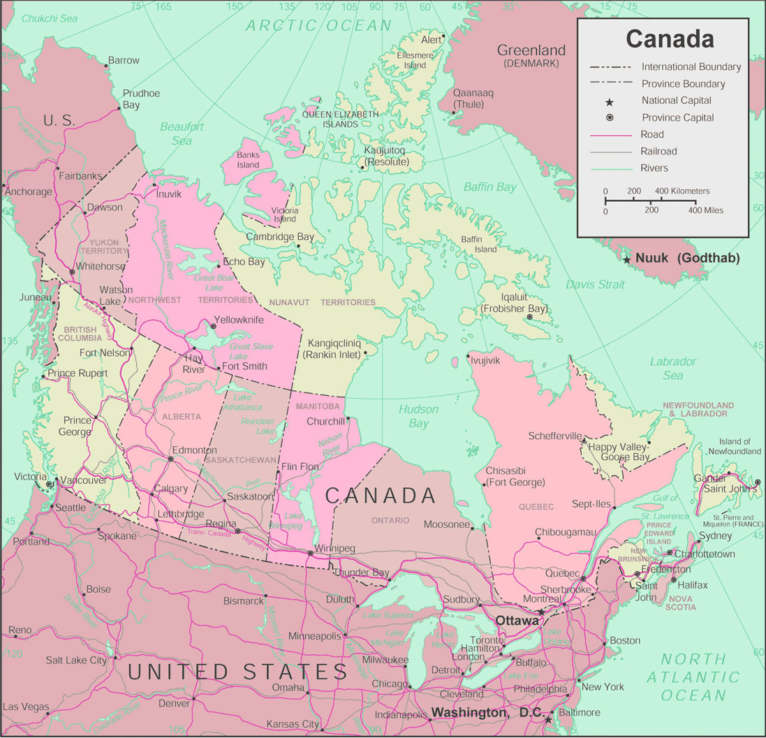
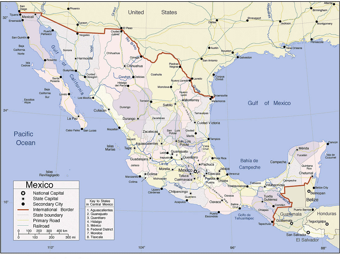
Map of North America North America includes The USA (United States of America), Canada and Mexico. When planning a vacation it is always good to consider a map of the region you will be travelling. North America has some of the worlds premier tourist destinations under it’s umbrella. All three countries that make up North America are veterans of the tourist trade and all forms of travel are well catered for. When planning a trip to this part of the world you are well served by looking over a map and choosing the destinations you are most interested in. Here are some interesting facts about this continent. The three main countries considered part of North America are as follow The United States of America (USA), Canada and Mexico. North America is the northern most continent of the Americas, situated in the Earth’s northern hemisphere and in the western hemisphere. The Oceans that border it are Arctic Ocean to the North and Atlantic Ocean to the East and the Pacific Ocean to the West, to the southeast is the Caribbean Sea, South America lies to the southeast. North America covers an area of about 24,709,000 square kilometres which is about 9,540,000 square miles, that is about 4.8% of the planet’s surface or about 16.5% of its land mass. It is the third-largest continent in area, following Asia and Africa, and the fourth in population after Asia, Africa, and Europe.
New Map For 2023
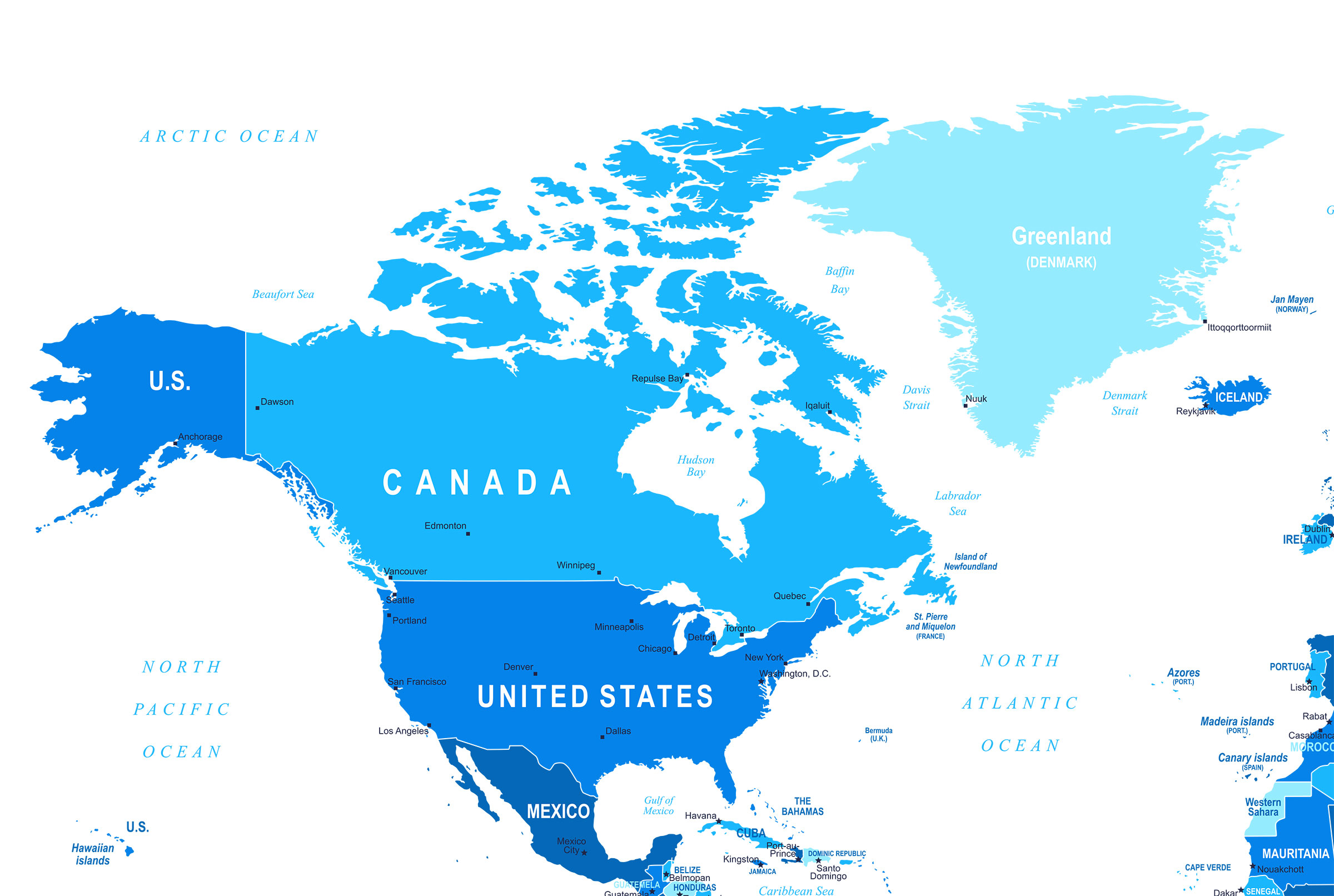
We have an updated map of North America for 2019. Nothing has really changed in 2018 or 2019. Mexico is still south of the USA and Canada is still to the north.
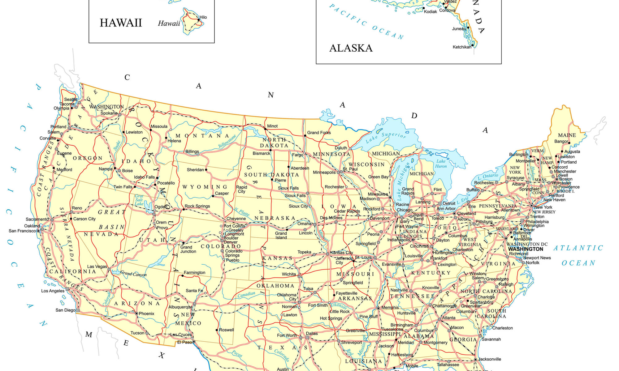
This map is pretty big simple map of North America. We will be adding more detailed map in the not to distant future. We will also be offering political and physical maps of North America and the countries that make up north America.
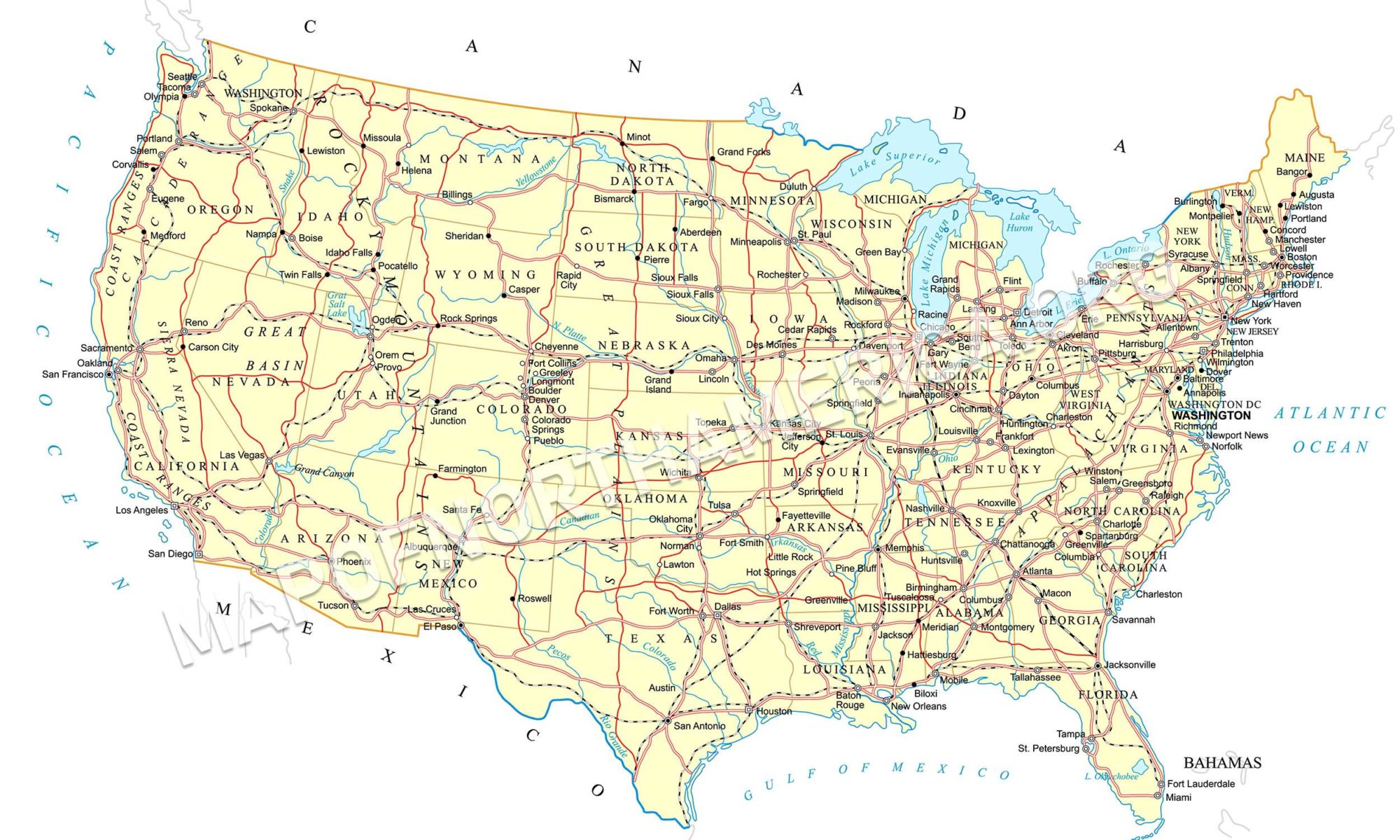
This being The United States of America, mexico and Canada. We have added a road map of the USA for 2019.
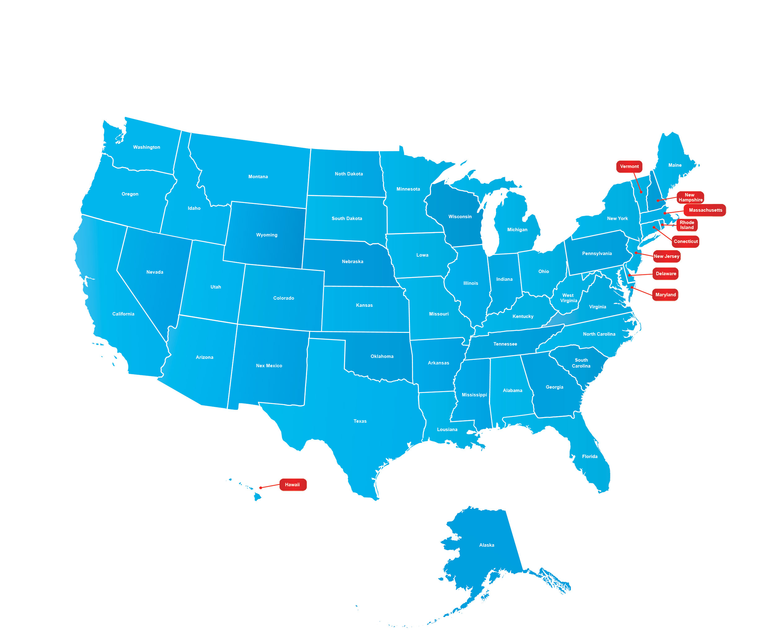
2023 Updated Map of North America
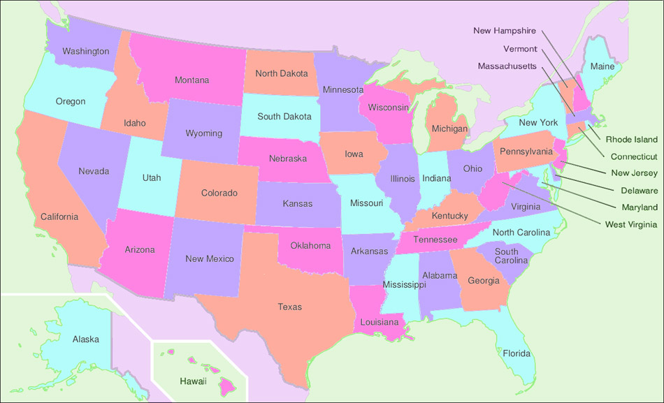
We have introduced a new map of North America for 2018. We intend to make the map clickable in the future. you will able to click on each state within the countries of Mexico, Canada and the USA.

In the near future we will also update the map with the capital cities of each state and country. We will also have a clickable list of states in a table below. A version of this map will eventually become the main map for this site.
We have picked a cool blue color as a base. It makes it easy on the eyes, if you have to look at it for a long time. Stay tuned for more updates in the near future.