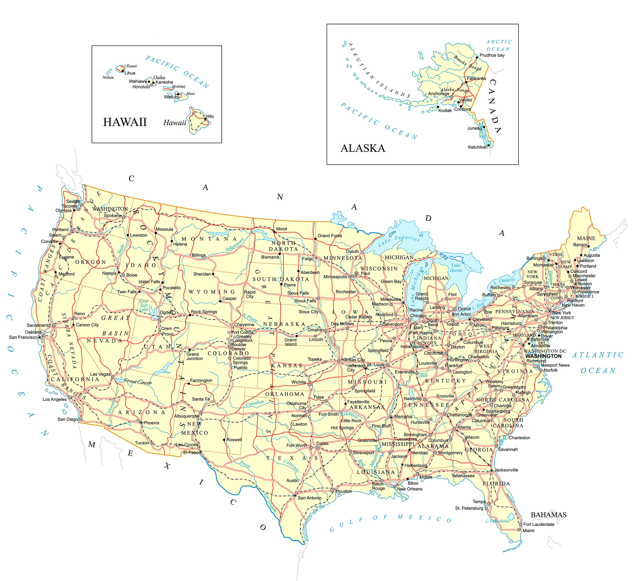
United States Map
We have added a very detailed USA Map to the site. Our original map was meant to be simple but the feedback from users has been to provide a map of the United States that has more detail and can be zoomed into to see all those details.
The USA map has the following:
- State names and borders
- Capital cities
- Other major Cities
- Highways and Major roads
- Rivers and lakes
- Major Railway routes
This is the most comprehensive USA map we have ever added to the site. Regular visitors to the site will have notice the flurry of activity in the last few months. We have made mapofnorthamerica.org a priority and there is much more to come.
We will also be updating Canada map and Mexico map.
Some interesting facts about the USA.
Capital : Washington, D.C.
Largest city : New York City
Population : 2017 estimate 325,719,178
Total area : 3,796,742 sq mi (9,833,520 km2)
GDP : $19.390 trillion
We have now added a USA Map 2019.
An easy to read map we introduced in 2018 has been moved here and this page will become a repository for all USA maps that added in the future.
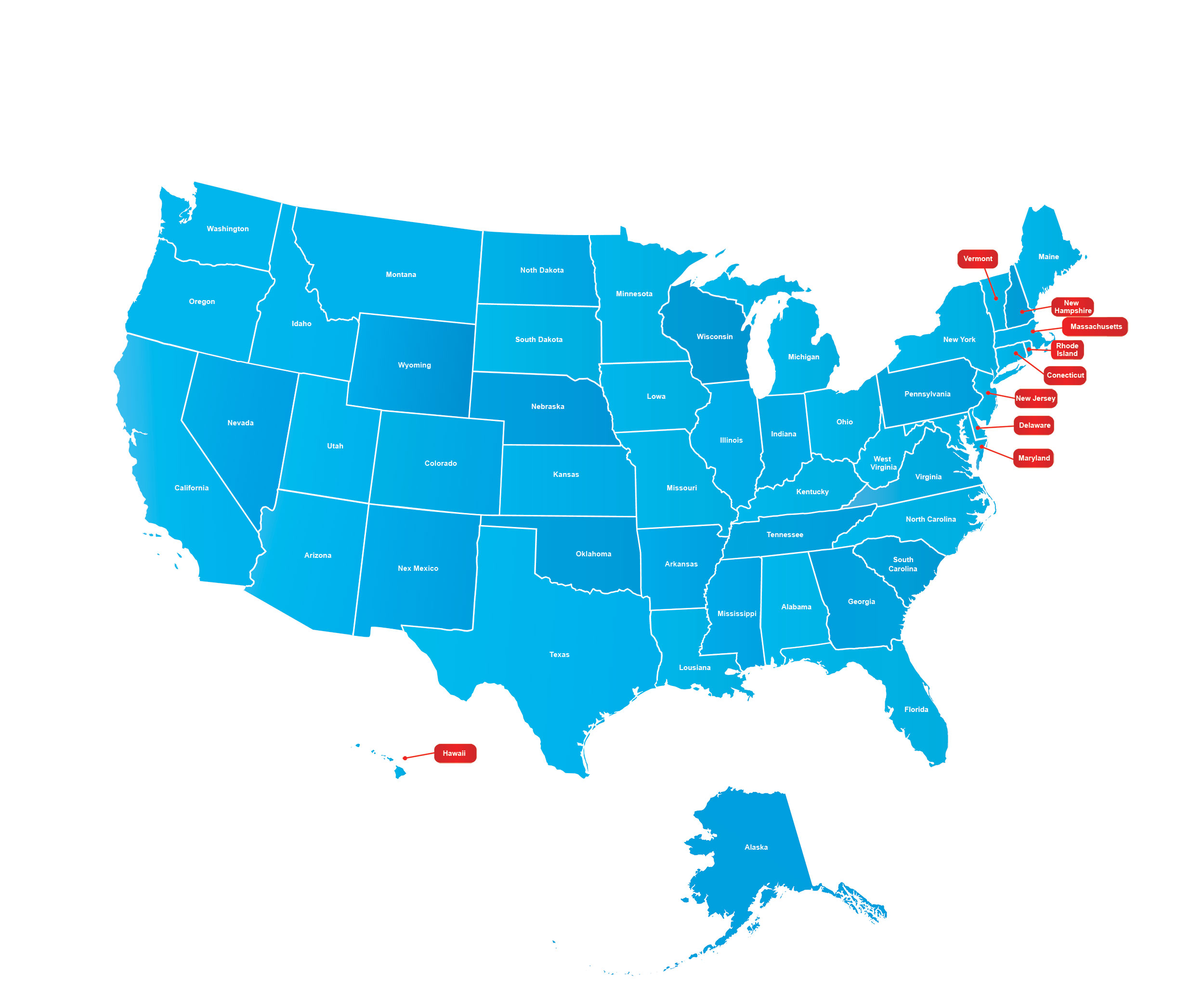
What are some of the most important aspects of the USA Map?
The above Map of the USA is huge and has easy to read visuals. A cool blue color was picked as a base. It makes it easy on the eyes, if you have to look at it for a long time. The United States of America is one of the most searched geographic terms on Google. At the time of writing search volume for maps on North America and the USA and all the different variations were well over 10 million searches a month. Most of the searches are students so we have made our maps as student friendly as possible.